

The South Downs Way National Trail
Back to Top of ListThe South Downs Way is one of Britain's best loved national trails. This long distance path stretches 100 miles across rolling chalk downland from Winchester in Hampshire to Eastbourne on the Sussex coast, with about 4,150 m (13,620 ft) of ascent and descent.
Over 100 miles of the trail fall within West Sussex, making it a fantastic way to explore the county on foot, cycle or even on horseback, as it's open to all three. Along the way, walkers are treated to sweeping countryside views, ancient woodland and dramatic coastal scenery, with charming villages, farm shops and traditional pubs offering welcome stops for refreshment. Whether tackled in one epic multi-day trek or broken into shorter, more manageable sections, the South Downs Way offers something for walkers of every ability, and is a perfect way to experience some walking excerise.
How long is the South Downs Way? The National Trail is 100 miles / 160 km in total
Don't Miss: The stretch through Cocking and up to Beacon Hill in the Chichester District, where far reaching views stretch out across the Weald to the north and towards Chichester and the coast to the south, making it one of the most rewarding sections of the entire trail.

Sussex Border Path
Back to Top of ListThe Sussex Border Path is one of the county's most rewarding national trails, a 150 mile (241km) walking trail that traces the historic county boundary from Emsworth in West Sussex to Rye in East Sussex. Closely following the old border between Sussex and its neighbouring counties, this hiking trail takes in a wonderfully varied landscape, from tranquil harboursides and rolling farmland to ancient woodland and quiet rural villages, with several stretches offering a genuine nature trail feel away from busier paths. It's a route that rewards those looking to explore Sussex on foot beyond the more well trodden trails, offering peace, solitude and a real sense of discovery at every turn. Whether tackled in full or broken into shorter, more manageable stretches, the Sussex Border Path is a brilliant way to see West Sussex's lesser known corners.
How long is the Sussex Border Path Route? The path measures a total of 150 miles (241km)
Don't Miss: The opening stretch around Emsworth and Chichester Harbour, where the path skirts glistening tidal creeks and salt marsh, alive with birdlife and offering some of the most peaceful coastal walking in the whole route.

Image Copyright John Tweddell
Monarch's Way
Back to Top of ListThe Monarch's Way is one of Britain's most historically fascinating long distance walking routes, tracing the extraordinary escape taken by King Charles II in 1651 following his defeat at the Battle of Worcester. Stretching 625 miles (1,006km), the trail begins at Powick Bridge in Worcester and finishes at Shoreham-by-Sea, the very spot from which the king finally fled to France. Along the way it passes through Stratford-upon-Avon, the Cotswolds and the Mendip Hills, before winding down through Sussex towards the coast. With around 45 miles falling within West Sussex, it's a wonderful route for history lovers keen to combine beautiful countryside with a genuine sense of the past.
What is the length of the Monarch's Way? Monarch's Way is 625 miles (1,006km) in its entireity.
Don't Miss: The stretch over Trundle Hill in the Chichester District, where the trail rewards walkers with sweeping panoramic views across Goodwood Racecourse and the surrounding downland, one of the finest viewpoints along the entire route.

Image copyright Angela Tysoe
Serpent Trail
Back to Top of ListThe Serpent Trail is one of West Sussex's most distinctive walking trails, named for the snaking, serpentine shape it traces across the landscape. Stretching 63 miles (102km), this scenic nature trail begins near Haslemere and Black Down on the Surrey border and winds its way south through heathland, ancient woodland and rolling countryside, finishing at the serpent's 'tail' in Petersfield, Hampshire. Along the way it passes through Liphook, Fernhurst, Petworth, Fittleworth, Duncton, Heyshott, Midhurst, Stedham and Nyewood, making it great for walkers seeking some genuine Sussex scenery away from busier trails. Whether you're after a serious walking exercise challenge or simply a peaceful trail to explore on foot, the Serpent Trail delivers in equal measure.
What is the length of the Serpent Trail? The whole trail totals 63 miles (102km).
Don't Miss: The stretch through Heyshott Common and on towards Midhurst, in the Chichester District, where the trail winds through beautiful ancient woodland and open heath, with the historic market town of Midhurst offering a well earned stop for refreshments along the way.

Image copyright Angela Tysoe
West Sussex Literary Trail
Back to Top of ListThe West Sussex Literary Trail is a scenic long distance walking route connecting Horsham with Chichester Cathedral, stretching 55 miles (89km) through some of the county's most beautiful countryside. Opened in 2007, the trail combines glorious West Sussex scenery with fascinating literary heritage, following footpaths, tracks and sections of the South Downs through landscapes linked to celebrated writers including Percy Bysshe Shelley, Hilaire Belloc, John Galsworthy, William Blake and John Keats. It's a rewarding route for anyone wanting to explore Sussex history, nature and literature side by side, whether walked in full or broken into shorter, more manageable stretches.
How long is the West Sussex Literary Trail? The route length of the Literary Trail is 55 miles (89km)
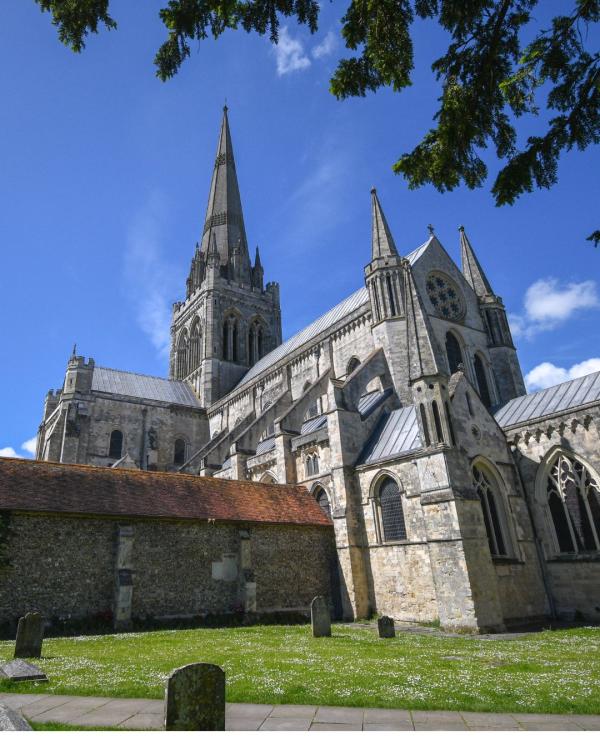
Don't Miss: The final approach into Chichester, West Sussex, where the trail leads walkers straight to the magnificent Chichester Cathedral, a fitting and memorable end point after miles of literary landscapes and rolling countryside.
The Midhurst Way
Back to Top of ListThe Midhurst Way is a scenic long distance walking route stretching 29 miles (47km) between Haslemere in Surrey and Arundel in West Sussex, with the historic market town of Midhurst falling roughly at its halfway point. Along the way, the trail passes through Camelsdale, Kingsley Green, Fenhurst, Henley, Easebourne, Midhurst, Lodsworth, Tillington, Coultershaw Bridge, Chingford Pond, Bignor, Westburton Hill, Houghton Forest and Fairmile Bottom, taking in some of the loveliest countryside the South Downs has to offer. Along the way you can discover, Nyetimber Vineyard, Bignor Roman Villa, Arundel Cathedral and Arundel Castle. There are some wonderful pubs, shops and unique accommodation stops to be disovered, including the Old Railway Station accommodation and tea room, The Hollist Arms for famous Sunday Roast, and for snacks, drinks and wondeful foodie bits, stop at the Lodsworth Larder or Cowdray farm shop and cafe. With Haslemere and Arundel both well served by rail, it's a convenient route for walkers wanting to explore this stretch of Sussex without needing a car at either end.
What length is the Midhurst Way walking route? the walking route measures 29 miles (47km)
Don't Miss: The section through Easebourne and past Cowdray, in the Chichester District, where the trail skirts the historic Cowdray Estate, offering glimpses of parkland, grazing deer and the atmospheric ruins of Cowdray House along the way.

The Petworth Way
Back to Top of ListOther long distance walking routes include the Petworth Way. A beautiful long distance walking route stretching 25 miles (40km) between Haslemere in Surrey and Arundel in West Sussex, making it an ideal two day walk for those wanting a shorter, more manageable trail. The route passes through the historic market town of Petworth roughly at its halfway point, offering a natural overnight stop before continuing on towards Arundel. Along the way, walkers are treated to classic West Sussex scenery, rolling countryside, woodland and quiet rural villages, with Haslemere and Arundel both well connected by rail, making it an easy route to plan without needing a car at either end.
How long is the Petworth Way walking route: The route is 25 miles (40km) split over two days.
Don't Miss: The town of Petworth, in the Chichester District, is home to the magnificent Petworth House and Park, where walkers can wander through ancient deer parkland before exploring Petworth's charming streets, packed with independent shops, antique dealers and cosy stops for coffee or lunch.

Lipchis Way
Back to Top of ListThe Lipchis Way is a long distance walking route stretching 39 miles (63km) from the Hampshire and West Sussex border near Liphook, all the way down to the golden sands of West Wittering beach. The trail takes its name from this journey, linking Liphook with Chichester along the way, and offers walkers a real change of scenery as it moves from wooded heathland in the north, down through rolling downland, before finishing at the Sussex coast. It's a wonderful route for those wanting to experience the county's full range of landscapes in one continuous walk, from forest to farmland to open water.
What is the route length of the Lipchis Way? The walk is 39 miles (63km) in total.
Don't Miss: The stretch through Kingley Vale National Nature Reserve. The home to one of the finest and ancient yew forests in Europe.

King Charles III England Coast Path
Back to Top of ListAnd don't forget the new epic King Charles III Coast Path - the longest coastal path in the world, tracing the entire coastline of England for around 2,700 miles (4,345km) once complete. In West Sussex, the trail runs 35 miles around Chichester Harbour and then 44 miles (71km) from West Wittering beach to Shoreham-by-Sea, offering some of the most striking coastal walking in the county. His Majesty the King officially inaugurated the trail at Seven Sisters in East Sussex on 19th March 2026, and the West Sussex stretch is now fully open, well signposted throughout with the distinctive National Trail acorn symbol and directional arrows.
What is the length of the King Charles III England Coast Path? The West Sussex section measures just under 80 miles, adding together the stretch around Chichester Harbour and the section from West Wittering to Shoreham by Sea. When fully complete the trail will measure an enormous 2,700 miles (4,345km)!
How far is the West Sussex section of the Coast Path? 44 miles (71km) + 35 miles (56km).
Don't Miss: The stretch through RSPB Pagham Harbour and around Selsey Bill, where walkers can spot wintering wetland birds and watch the local fishing fleet bringing in the day's catch, before the trail rounds the headland towards Bracklesham Bay.
